October 30, 2024
The Best AIS Tools for Skippers
AIS (Automatic Identification System) is an important tool for fishermen. With AIS, you can monitor both your own and other vessels, which helps with everything from avoiding collisions to optimizing fishing. But coverage varies between AIS services. In this post, we look at different AIS sources and rank the best services for fishermen.Skrevet av
Tomas Roaldsnes
How do the different AIS sources work?
Terrestrial AIS (base stations)
Terrestrial AIS collects signals via land-based receivers, which typically have a range of 30-50 nautical miles from the coast. It provides excellent coverage in busy coastal areas but doesn't extend far out to sea.
Advantages: Precise coverage near the coast.
Disadvantages: Limited range.
Satellite AIS (SAT-AIS)
SAT-AIS uses satellites to receive AIS signals over large distances, including far out to sea. Coverage depends on the number of satellites in orbit and their position. More satellites in low Earth orbit (LEO) provide better coverage, as they pass more frequently over different areas.
Advantages: Global coverage, must-have for oceangoing vessels.
Disadvantages: Higher cost, often delay in position updates.
Dynamic/Roaming AIS
Dynamic or roaming AIS means that vessels themselves collect AIS data via VHF and transmit it onward, providing additional coverage in areas with high traffic. This extends coverage in sea areas with many vessels that contribute to collecting and sharing data.
Advantages: Flexible, good coverage in areas with heavy ship traffic.
Disadvantages: Variable coverage depending on ship traffic.
What provides the best coverage?
Good coverage with SAT-AIS depends on the number of satellites and when they orbit over the vessels. More satellites in low Earth orbit means more frequent updates, providing more continuous and precise data.
Good update frequency on positions is important to be able to act quickly when a vessel shoots off or changes course. It's also important for history with detailed trawl tracks.
AIS and tracks are also important for coordinating fishing between vessels. When you arrive at the fishing ground, you don't want to start fishing where several vessels have just been fishing. Good AIS data together with a good bathymetric map is also important for distinguishing the different depths other vessels have fished at, so you can fish at other depths when you must fish in the same area.
The best AIS services for fishermen
1. Catchwise
In less than a year, Catchwise has become a favorite among many skippers in Norway. Catchwise is designed specifically for fishing vessels and offers both terrestrial, dynamic, and satellite-based AIS.
In addition to AIS, Catchwise offers several features for fishing such as estimated bottom temperatures, historically good areas, and where there has been the most fishing activity in the last week.
Advantages:
· Good AIS coverage
· Combines AIS from multiple providers
· Terrestrial, satellite, and roaming
· Wind, waves, and ocean currents (surface and seabed)
· Where there has been the most fishing activity in the last week
· Temperature at the seabed
· Historical catch (ERS and landing notes)
· Boundaries, fishing banks, and fjord lines
· Detailed ice charts from satellite images
· High focus on user experience
Disadvantages:
· Not global coverage like general AIS services
· Only shows fishing vessels and vessels related to fishing
You can see a demo of Catchwise here.
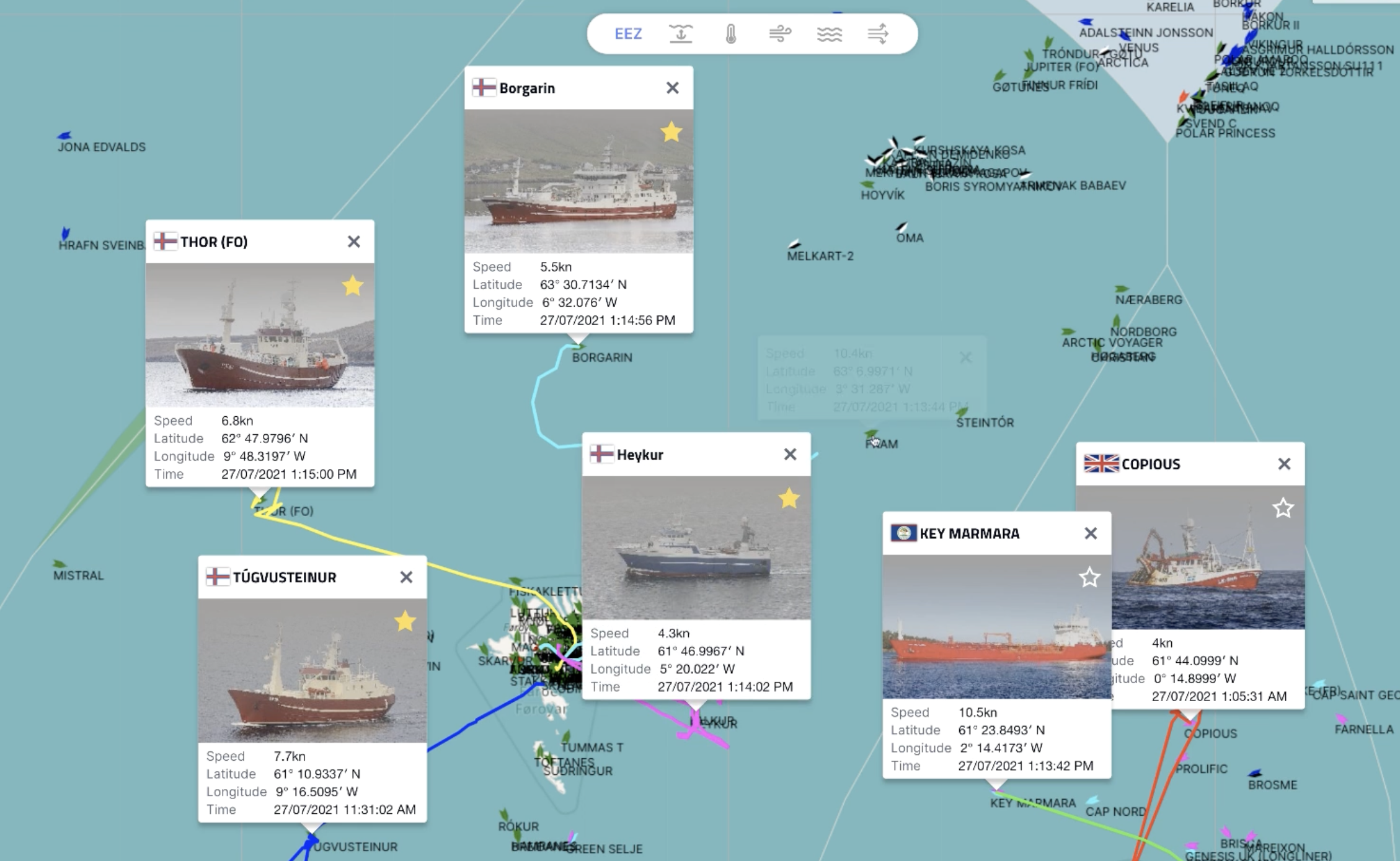
Source: Screenshot from video on Fishfacts.com
2. Fishfacts
Fishfacts is a popular AIS service for fishing and aquaculture. The service offers good AIS coverage with both terrestrial and satellite-based AIS.
Fishfacts has a range of features for fishing such as weather, wind, and ocean currents, as well as sea conditions. The platform also has a number of other modules for fishing and aquaculture, such as CRM, profitability analysis, and overview of service providers.
Advantages:
· Good AIS coverage
· Ability to customize trawl tracks with speed or different vessels
· Weather, wind, and ocean currents
· Option for seabed as background map
· Detailed ice charts from satellite images
Disadvantages:
· Somewhat poorer user experience
· Fewer support features for fishing
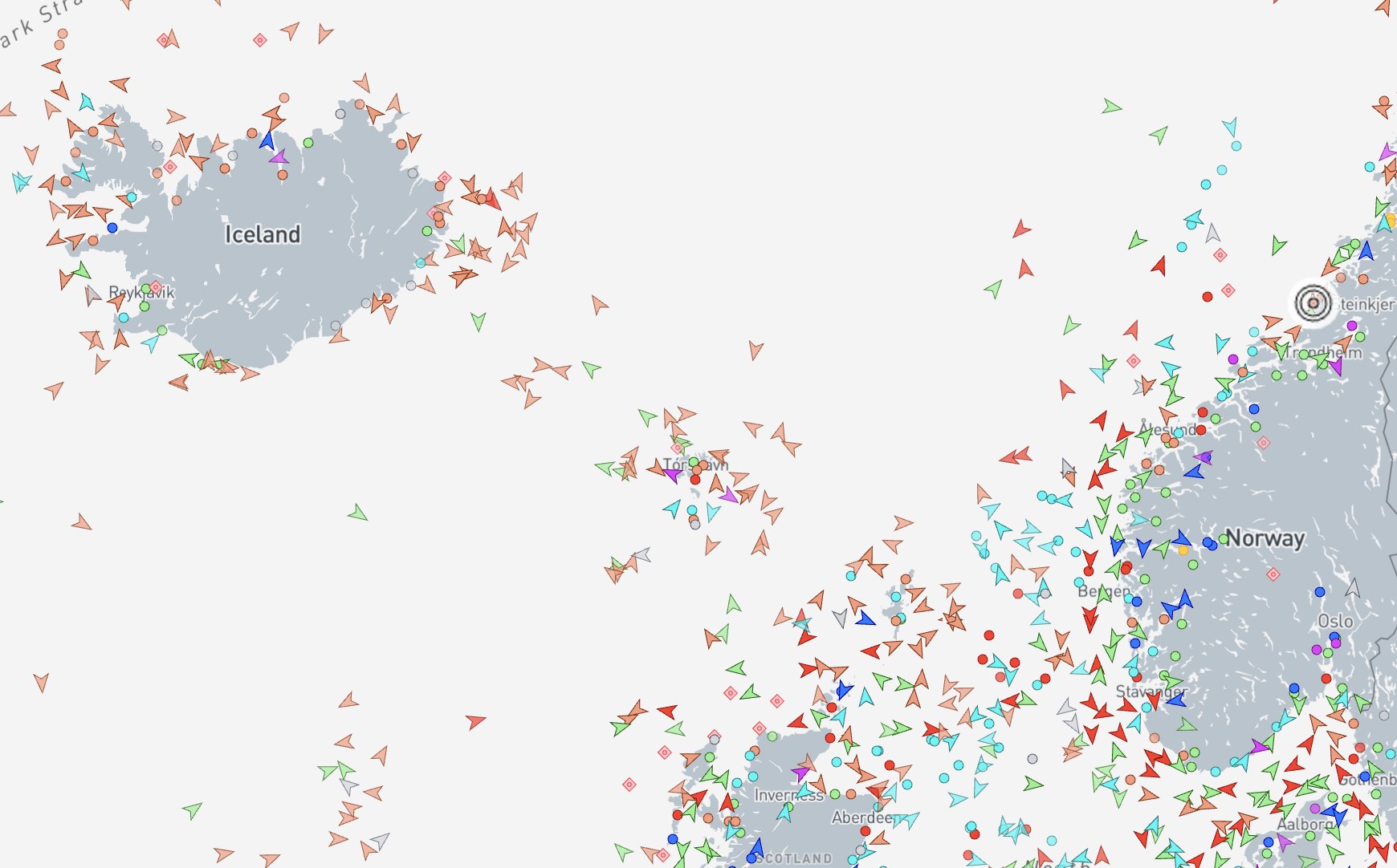
Source: Screenshot from Marinetraffic.com
3. MarineTraffic
MarineTraffic is one of the most well-known AIS services globally and offers terrestrial and satellite-based coverage through partners. This provides flexible coverage at a reasonable price.
Advantages:
· Good global coverage
· Very good coastal coverage from terrestrial AIS
· Trawl tracks back in time with playback
· Good trawl track if you only need to view one vessel at a time
· Affordable subscription for one user
Disadvantages:
· Very poor satellite AIS coverage
· Unsuitable for oceangoing fishing vessels
· Cannot view multiple tracks simultaneously
· No support features for fishing
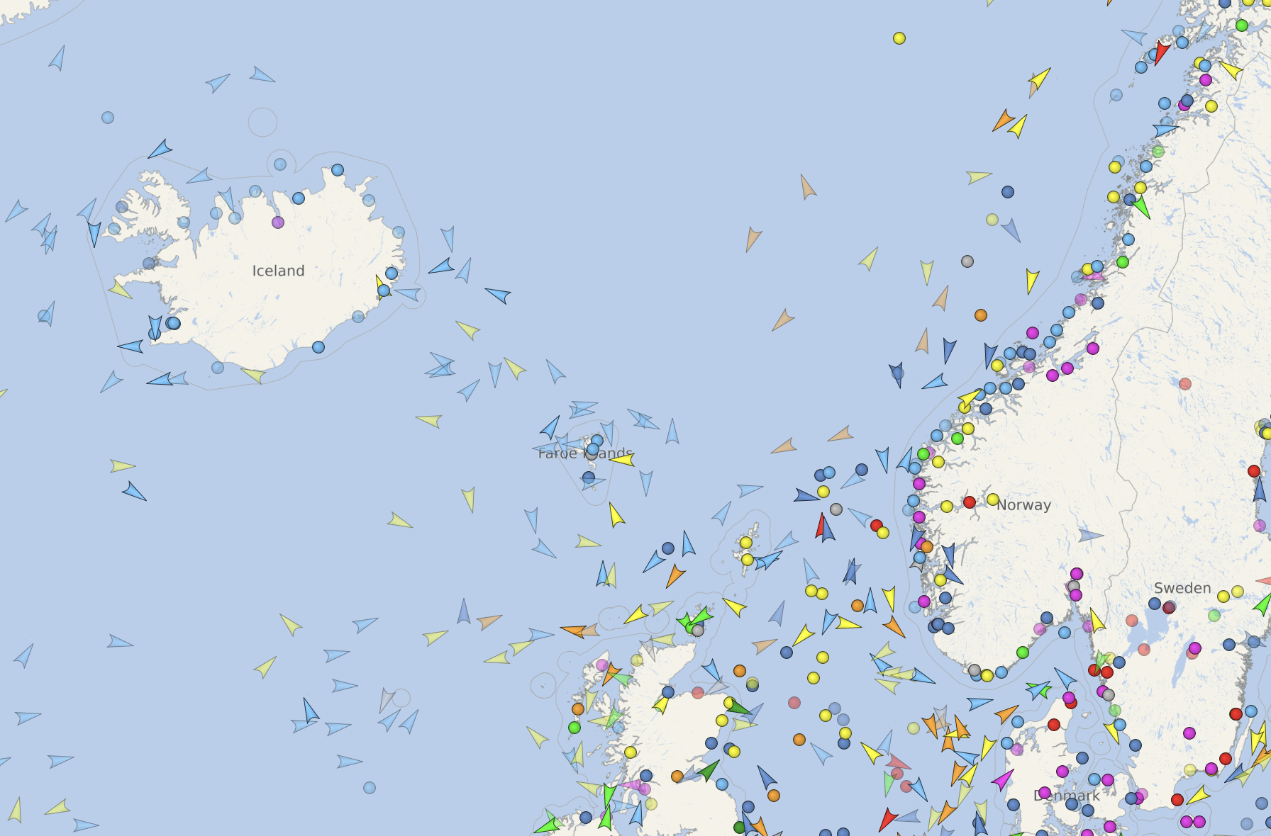
Source: Screenshot from Vesselfinder.com
4. VesselFinder
VesselFinder provides a simple and user-friendly solution with both terrestrial and satellite-based AIS coverage. The service is ideal for those who only need basic tracking without extra features.
Advantages:
· Somewhat better satellite coverage than MarineTraffic
· Global coverage
· Affordable price for basic functionality
Disadvantages:
· Cannot view multiple tracks simultaneously
· No support features for fishing