Plankton, Upwelling and Altimetry: Why More Skippers Are Looking Below the Surface
Most fishers know that some spots just produce better than others. The reasons are rarely obvious from the surface. One piece of the puzzle that marine scientists have studied extensively is plankton, and the oceanographic conditions that drive it. Here's what the research actually says, what we still don't know, and where you can find these layers in Catchwise.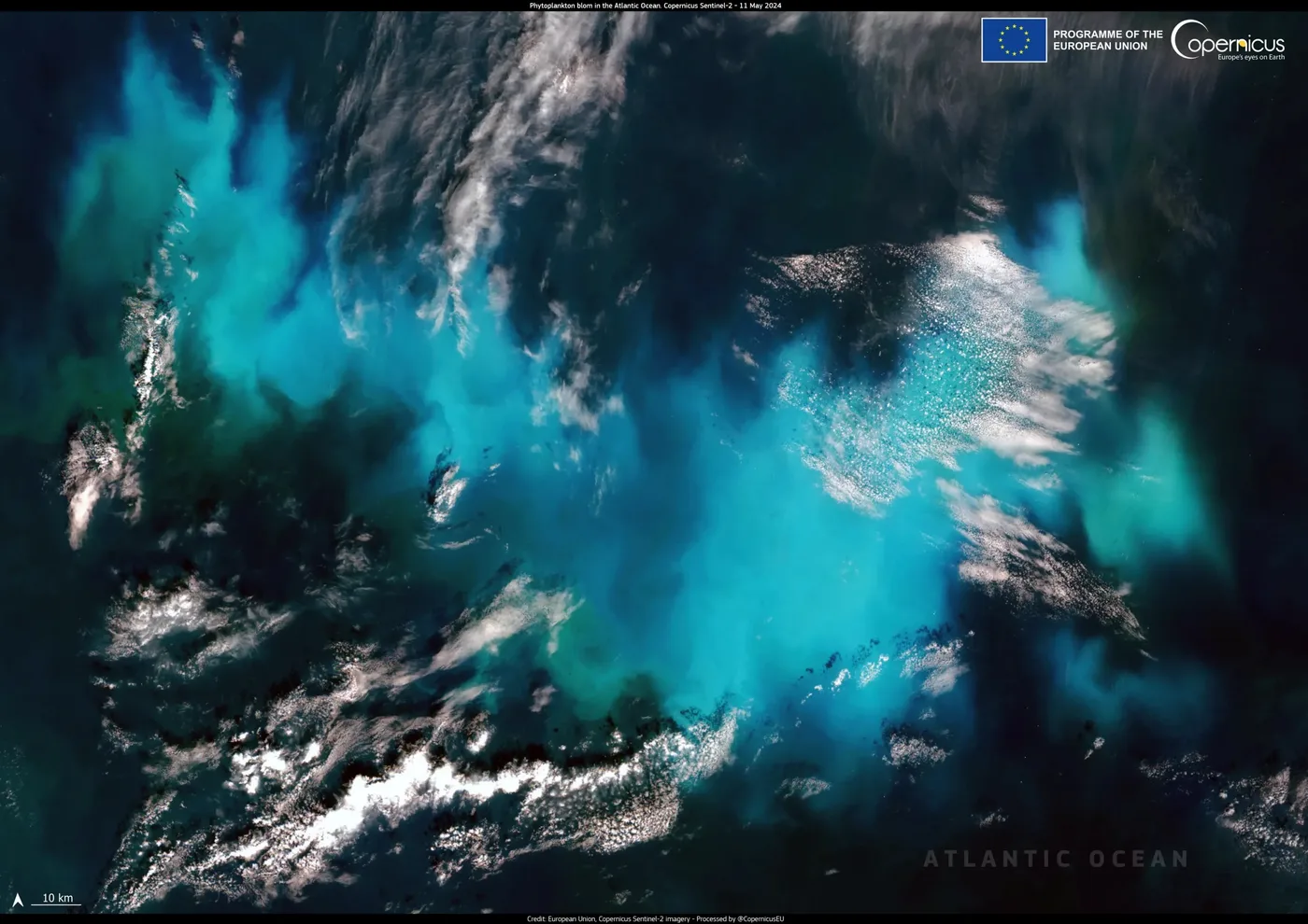
Large phytoplankton bloom in the Atlantic Ocean, captured by Copernicus Sentinel-2, 11 May 2024. © European Union, Copernicus Sentinel-2 imagery — source: EU Space Policy / European Commission (DEFIS).
June 5, 2026 · Written by
Ann Elinor Aasen
Key takeaways
🌊 Plankton — phytoplankton and the zooplankton that graze them — are the base of the marine food web; where upwelling concentrates them, predators tend to follow
🛰️ Catchwise brings plankton, upwelling and altimetry layers together, with a one-week forecast, under Weather & Conditions
🧭 Skippers are pairing them with AIS to see where conditions and the fleet's activity line up
What are we actually talking about?
Phytoplankton are microscopic plant-like organisms that photosynthesize near the ocean surface. Zooplankton are tiny animals — copepods, krill, larvae — that feed on them. Together they form the foundation of the marine food web.
Upwelling is the process by which wind and currents push warm surface water aside, drawing cold, nutrient-rich water up from depth. Those nutrients fuel phytoplankton growth.
Altimetry uses satellite measurements of sea surface height to map ocean currents and eddies — rotating water masses that influence how nutrients and organisms are distributed across the water column.
What does the research say?
The relationship between plankton and marine ecosystems is well-established, though what it means for any individual fishing trip is far more complex.
Plankton are vital food sources for pelagic fish and the larvae of virtually all marine species (Springer Nature, Discover Animals, 2025). When upwelling concentrates nutrients and zooplankton, predators follow. Research modelling four major upwelling systems found that nutrient supply and surface currents predicted zooplankton hotspot locations that closely matched what survey ships actually found (Messié et al., Geophysical Research Letters, 2017). The broad mechanisms are reasonably well understood. The local and seasonal detail is not.
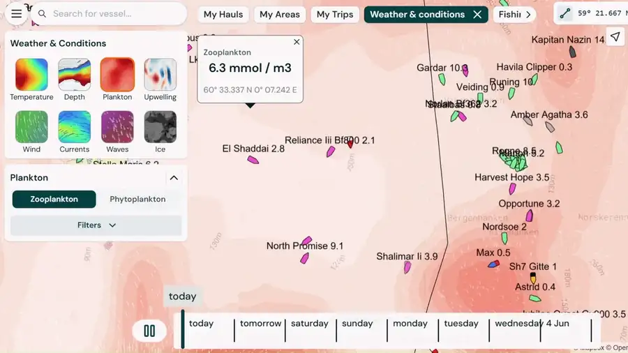
The plankton layer in Catchwise, with a one-week forecast for phytoplankton and zooplankton concentration.
How people are using it
Skippers are using the plankton and upwelling layers to look into their own fishing areas and observe whether current conditions appear to affect their fishery. Using the one-week forecast, they can see where plankton concentrations and upwelling activity are expected to develop and plan around that.
A number of skippers are also combining these layers with AIS, keeping an eye on where other boats are fishing, and whether those areas overlap with higher plankton concentrations. It adds another dimension to how they read what's happening out there.
What skippers do with that information is entirely up to them. Some use it to consider new fishing grounds. Others look at it when thinking about the timing of their trips.
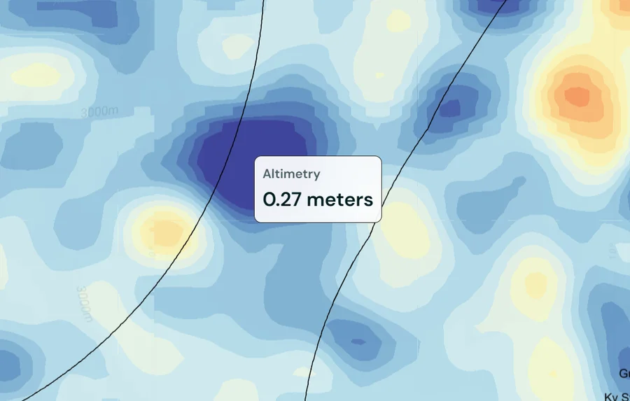
The altimetry layer in Catchwise, where sea-surface-height variation makes eddies and current boundaries visible.
Where you find this in Catchwise
You can find the plankton layers under Weather & Conditions in Catchwise. Here, you can turn on layers for both phytoplankton and zooplankton concentration across your fishing area, based on satellite imagery. Instead of only seeing the current situation, you can use the one-week forecast to understand how conditions are expected to develop over the coming days.
You can also adjust the density range shown on the map. This lets you filter out the full spectrum and focus only on the concentration levels that are most relevant to your fishing.
The upwelling layer shows where cold, deep water is currently rising toward the surface — areas where the physical conditions that support plankton growth are active.
Altimetry maps sea-surface-height variation, making eddies and current boundaries visible.
Want to explore it yourself?
Sign up and take a look at the plankton, upwelling and altimetry layers for your area.
Try Catchwise
Try Catchwise on your next trip! Click the button below to get started. No credit card required.
Get started